Rain and Ropes: A jungly affair at Santa Clara Alta
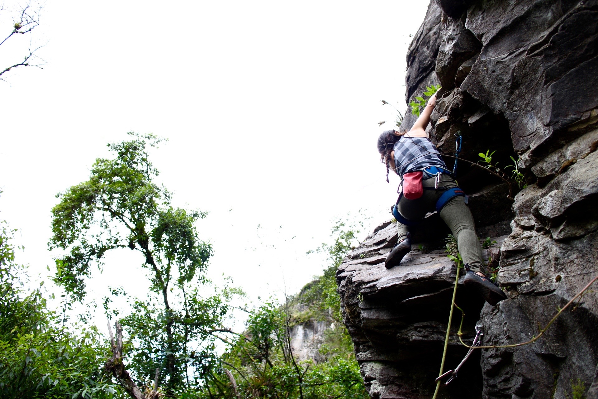 New friend Karla cruises through the start of Yapa Cósmica, a supposed 6b/5.10d.
I guess I should have known to bring a crash pad to Ecuador.
I left mine Stateside thinking I’d buy something bigger and better here in Quito, but it turns out our weird dirty back-mattresses are not exempt from Ecuador’s high import taxes. Unwilling to pay $300 for a Mad Pad and unable to find a local manufacturer, I’ve resorted to sport climbing on most weekends.
And it’s not so bad! Every time I go out, I make new friends and see beautiful places. I’ve been using this time to really rein in The Fear, and I’m growing more confident with every trip. I can’t wait to get back to Little River Canyon and take down some old projects.
In the meantime, though, I have Santa Clara Alta. Its gray volcanic rock has little in common with that of the Canyon, with few roofs, thin cracks, and what I must describe as chunky slab. The approach, however, feels like I'm back in Alabama — if Alabaman forests were jungly Andean affairs, home to giant birds and (probably) baby dinosaurs.
The hike to the crag takes about 30 minutes and is far more adventurous than the nonexistent approach of nearby La Perrera. Some merciful souls have outfitted the way with bridges, ladders, and fixed lines, but the trek involves some real scrambling. Having made it once in Chacos, I highly recommend wearing hiking boots. Sandals aren’t a bad idea for the shallow river crossing, though.
To start the journey, you take the trail to the left of the road that got you there. You follow the river for a bit, beginning with a dirty choss scramble. After crossing some bridges, conquering the water, and climbing a few ladders, you’ll eventually arrive at a ladder and a sign. Uphill, it declares, exists “PELIGRO,” while the ladder leads to casual hiking. Go toward the danger.
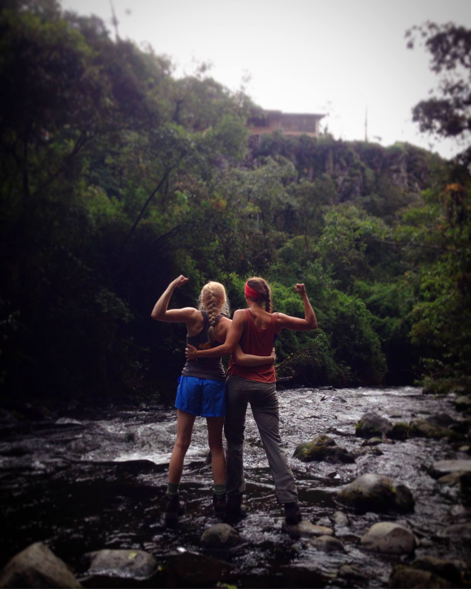 When it rains, you gotta learn to love the water. Photo cred to nueva amiga María José <3
I first visited this crag a few weeks ago with Ecuadorian friends. Then I met Sophia, another Georgia lady climber, thanks to Instagram magic and the tininess of the climbing universe. After a Wednesday gym sesh together, we decided to spend the three-day weekend at Santa Clara Alta. Unfortunately we were rained out a few hours into day two, but we're already big fans of the Quito area's newest sport crag.
Santa Clara Alta is about an hour south of the city and home to 54 routes spread across three walls. Grades currently range from 6a/5.10b to 7c/5.12d, and the potential for further development seems limitless. Trad isn’t so big in Ecuador, but a few mixed routes exist here.
A small group of climbers, with support from the Ecuadorian government, has been releasing rockbound potential all over the country in recent years. Hardware is generally in great condition — much better than some of the stuff I climbed on in the Dirty Sketchy South. I’ve yet to clip into a spinning hangar and have seen zero rusty bolts. Still, a helmet is always a good idea in case of falling rock.
Although this crag, at about 2,600m, is definitely high-altitude, it’s significantly lower than, say, Quito. This means more humidity, denser forest, and little critters that want to bite you. You don’t have to worry about Zika or those other nasty illnesses in the Andes, but it sucks to be itchy, so bring bug spray and wear pants.
Santa Clara Alta is one of two crags near the Río Santa Clara. The other is Santa Clara Baja, which was actually the first sport crag to be developed near Quito. It’s small but plays an important part in Ecuador’s climbing history.
Santa Clara Alta sits on public land, and climbers aren’t the only ones who use it. In fact, we’re a minority. Hikers, runners, bikers, and picnicking families keep things bumping in the forest and near the trailhead. There are even bathrooms and a gazebo under which to wait out rain, and sometimes vendors set up shop with choclo, sandwiches, and ponchos for sale. You can hike two hours to camp near some waterfalls, or you can set up your tent in an easier-access riverside clearing. Parking is $1 per car, but there’s no fee to camp or climb. Just remember to clean up after yourself and other humans.
The best time to climb in this area, according to Topos Ecuador, is during the dry season from June to September. You can climb any other time of the year too, but you might get rained out like we did.
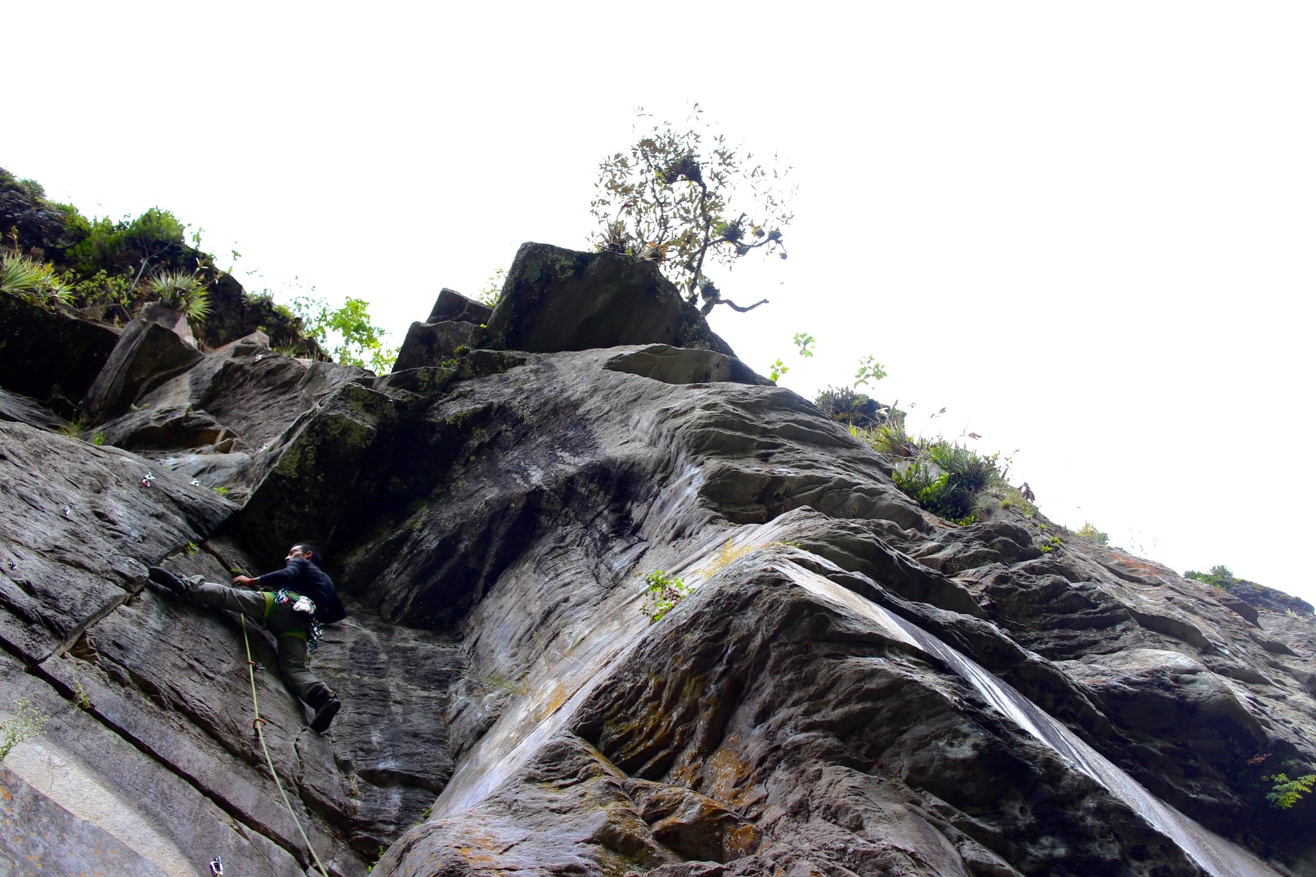 Juan, aka El Juanca, aka Diablito, traverses to the crimps on that same "10d."
Bus Directions from Quito, Ecuador to Santa Clara Alta
I get lost so you don’t have to! Sophia and I had some trouble getting to the crag on Friday because most people we met were confused about where we wanted to go; Santa Clara Alta is close to several natural tourist attractions, and we ended up changing buses twice and finally taking a pricey camioneta. So even though the directions below aren’t exactly how we arrived, they’ll definitely get you to the crag.
In Quito, catch the Vingala bus at the intersection of General Veintimilla and Isabel la Católica. Pay 50 cents to take that to Selva Alegre, then take the Expreso Calsig bus to Rumipamba. From there you can take a $5ish camioneta to the trails. (You can also take a camioneta from Selva Alegre, which is faster but will cost you around $20). If your ‘neta driver isn’t sure where you want to go, tell him you’re looking for la Cascada Vilatuña near Cotopaxi National Park. Chances are he won’t know what waterfall you’re talking about, but when he hears “Parque Nacional Cotopaxi,” he’ll know the general direction.
BUT look out, because when you get close you’ll be going up this big hill, and a chossy rock face with a blue and white railing/shrine-looking thing will pop up ahead on the right. The road keeps going straight, and he will probably want to go that way, but you want to take the steep downhill to the left instead.
Santa Clara Alta is very close to Cotopaxi. Any time you’re thinking about climbing there, make sure to check the volcano’s status. If an eruption looks imminent, go somewhere else.
More information about routes and navigation may be found in Felipe Proaño Iturralde’s guidebook, Rutas de Escalada en Ecuador, Vol. 1: Zona Oriental de Quito. You can find it at Monodedo, Campo 4, the tiendita at Sigsipamba, and probably other places.
So, who wants to come climb in Ecuador with me?! Anybody know a better way to get to the crag by bus? Any recommendations for bug spray that actually works? Leave it below!